Course F
F Kinubariyama, Nagoe kiridoshi
Kinubariyama Nagoe Kiridoshi
This course takes you from the Nagoe kiridoshi, a key transportation route in the Zushi area, to the Oogishi (Big Bank), to Mt. Korobari, with its splendid southeastern view of downtown Kamakura, and to Hokokuji Temple, famous for its bamboo trees.
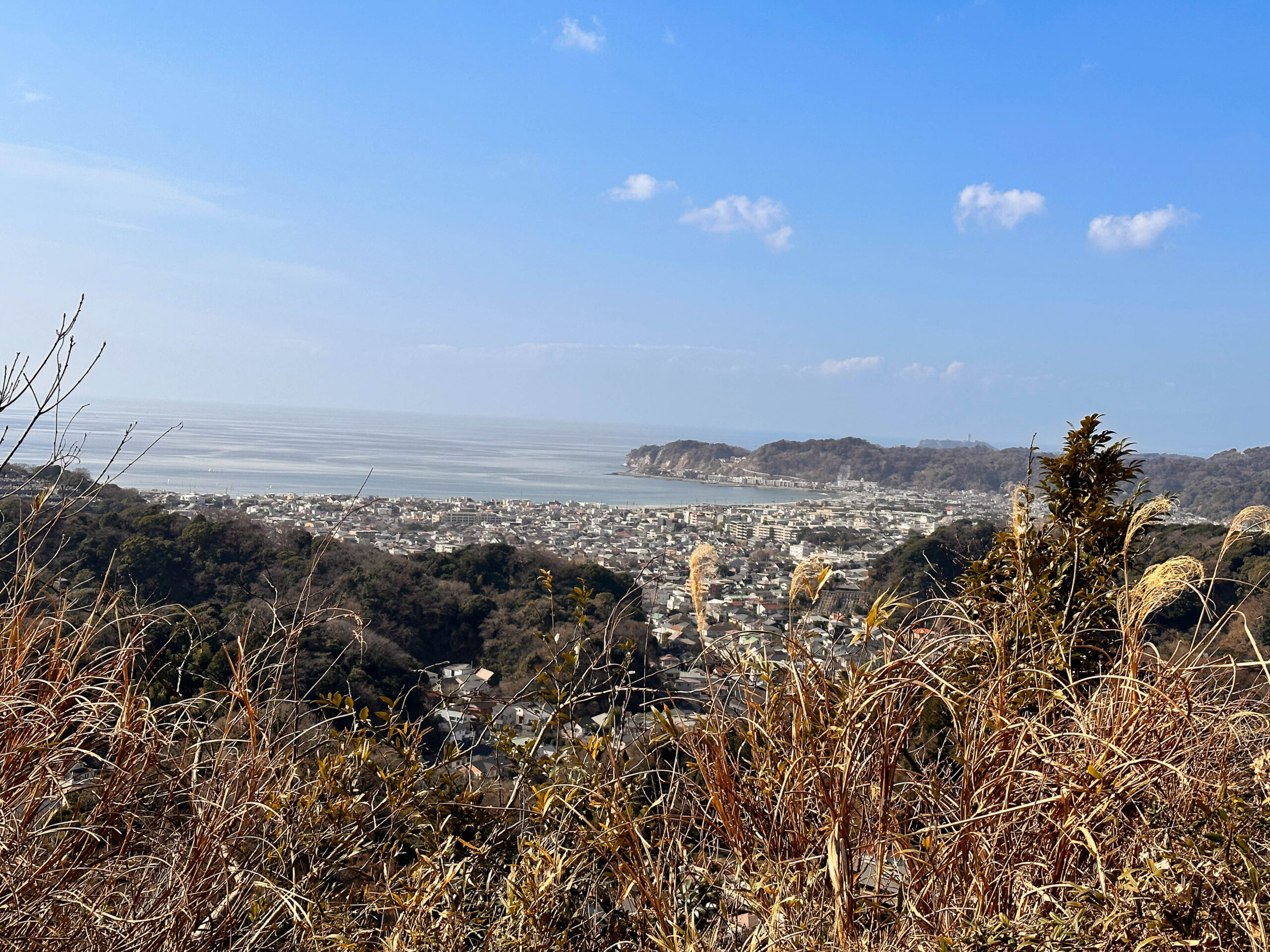
The view from the summit is spectacular, with the curve of Yuhigahama beach and Sagami Bay below, and a panoramic view of the city of Kamakura. It is a good place to take a lunch break as you can rest and relax.
Course Highlights
- Elevation: Relatively gentle ridge trail, some steep and slippery.
- Shoes: low-mountain hiking shoes

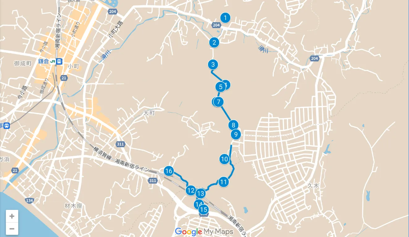
![]() 00:00 Entrance to Heisei Pilgrimage Route
00:00 Entrance to Heisei Pilgrimage Route
Paved roads and steep mountain roads in residential areas
![]() 00:20 Kinubari KInubariyama (Kinubari)
00:20 Kinubari KInubariyama (Kinubari)
Gentle ridge road
![]() 00:40 South summit of Kinubariyama.
00:40 South summit of Kinubariyama.
Gentle ridge road
![]() 00:50 Mt. Kinjari/Jomyouji directional entrance
00:50 Mt. Kinjari/Jomyouji directional entrance
(Kinubari/jyomyoji)
mountain path in bamboo thickets
Residential promenade
Nature Park Trail
01:30 Great Bank of Sarubatake
Flat ridge road
02:10 Nagoekoridoshi
(Nagoekiridoshi)
Nagoekoridoshi round trip
Gentle mountain road
02:40 Nagoe Kiridoshi Exit
Course Highlights
Walking along the ridge from Kinubariyama, the view is spectacular. Walking along the wall-like path of a large bank, you can feel the activity of people in the Kamakura period, which was the stone quarry of that time.
Kamakura, where Minamoto no Yoritomo established his residence in 1180, was a strategic location surrounded by the sea to the south and hills on three other sides. Therefore, it is thought that most of the overland routes into Kamakura were either narrow and steep mountain paths over ridges or dangerous paths under the cliffs at the edge of the waves.
The Nagoe Kiridoshi was one of the main roads connecting Kamakura and the Miura Peninsula, and there are many stone quarries, caves, and other remains from that period in the surrounding area.
The Mandarado Yagura group along the way will be open to the public for a limited time.
See Zushi City HP.
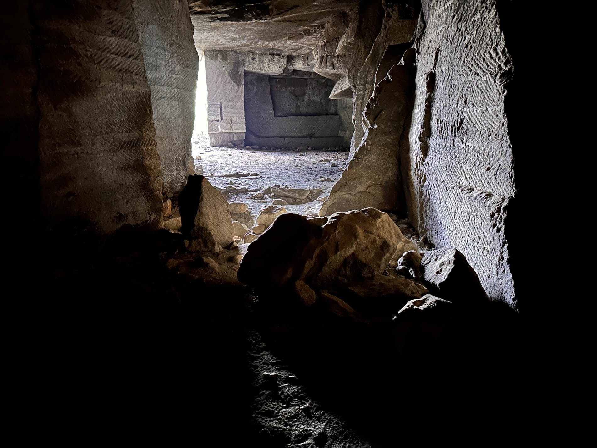
Quarry Site ❹
Just before KInubariyama
This is the site of the Kamakura Stone Mining Site from the Kamakura Period.
The interior is large, dark even in daylight, and so spacious that light cannot reach it with a cell phone light.
If you visit, a flashlight will allow you to observe the chisel marks inside and envision how stone cutting was done in those days.
How did they transport the quarried stones from here? It makes you wonder.
Kinubariyama summit ❺
The origin of Kinubariyama comes from a legend that on a summer day, Shogun Minamoto no Yoritomo covered the mountain with a white robe to make it look like snow in order to fulfill his wife Hojo Masako’s wish to see a snow-covered landscape.
The view from the top of the mountain, which overlooks the city of Kamakura, the sea, and even Mt. Fuji, was used in the scene in the movie “Umimachi diary” where Sachi (Haruka Ayase) and Suzu (Suzu Hirose) climb the mountain together. You can enjoy “Umimachi diji” on the big screen at Villa Kamakura. (If you stay at Yuigahama Chiyo, you can watch it on a large 120-inch screen).
UMIMACHI DIARY Trailer
The big bank of Sarubatake ⓫
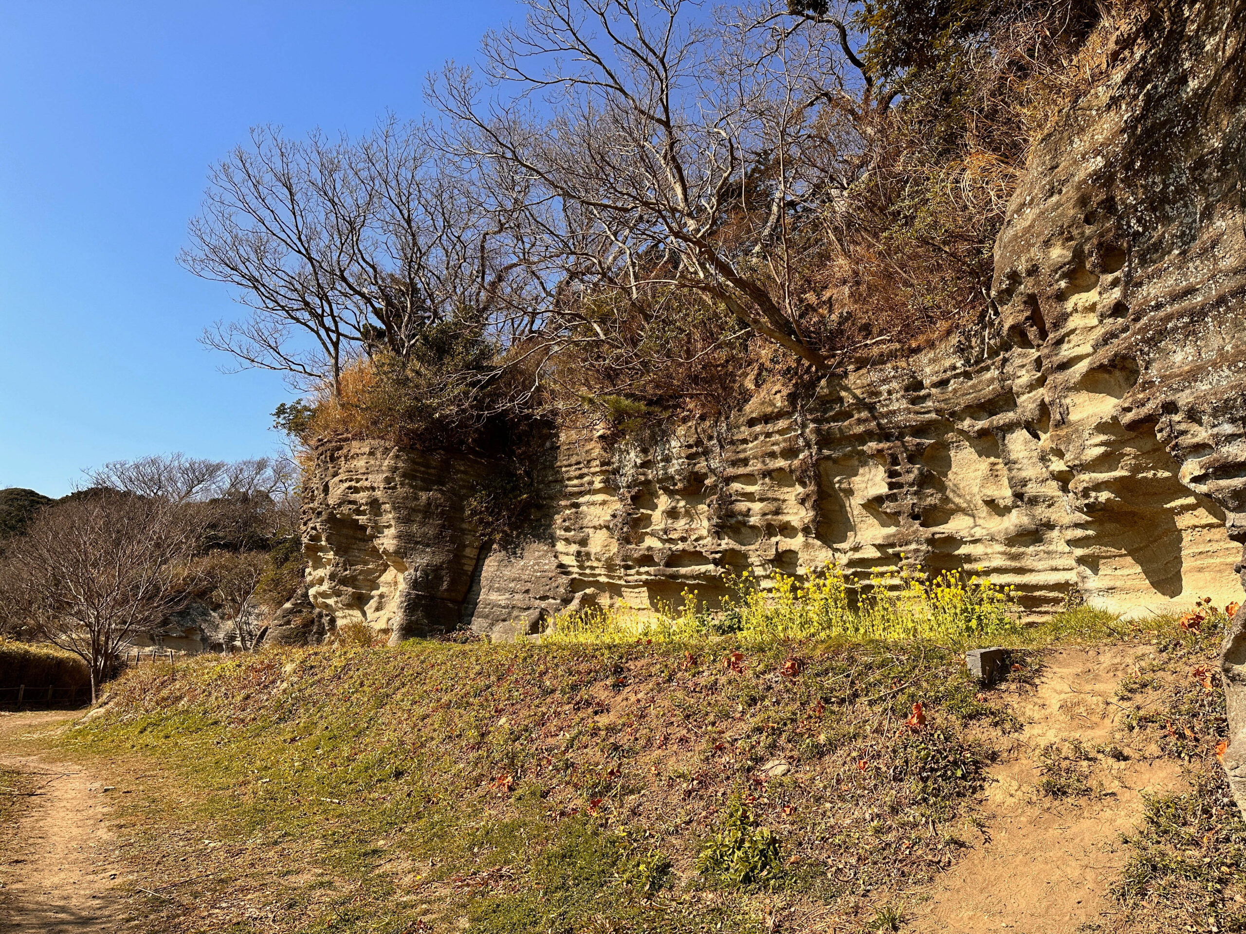
From the viewing platform at Sarubatake, the Ooigishi is a series of sheer cliffs 3~10 meters high for more than 800 meters along the ridge.
Along with the kiridoshi, it has been said to be a defensive site from the early Kamakura period, but excavations have now confirmed that it is the site of a stone quarry that was eventually left in the form of a castle wall as a result of large-scale stone quarrying operations.
Mandarado Yagura group ⓭
About 150 holes of medieval “yagura” remain in the Mandarado Yagura group on the northern ridge of the Nagoe Kiridoshi.
The existence of this many “yagura groups” is considered rare in Kamakura.
It is said that there used to be a “mandala hall” at this location to hold memorial services for the dead.
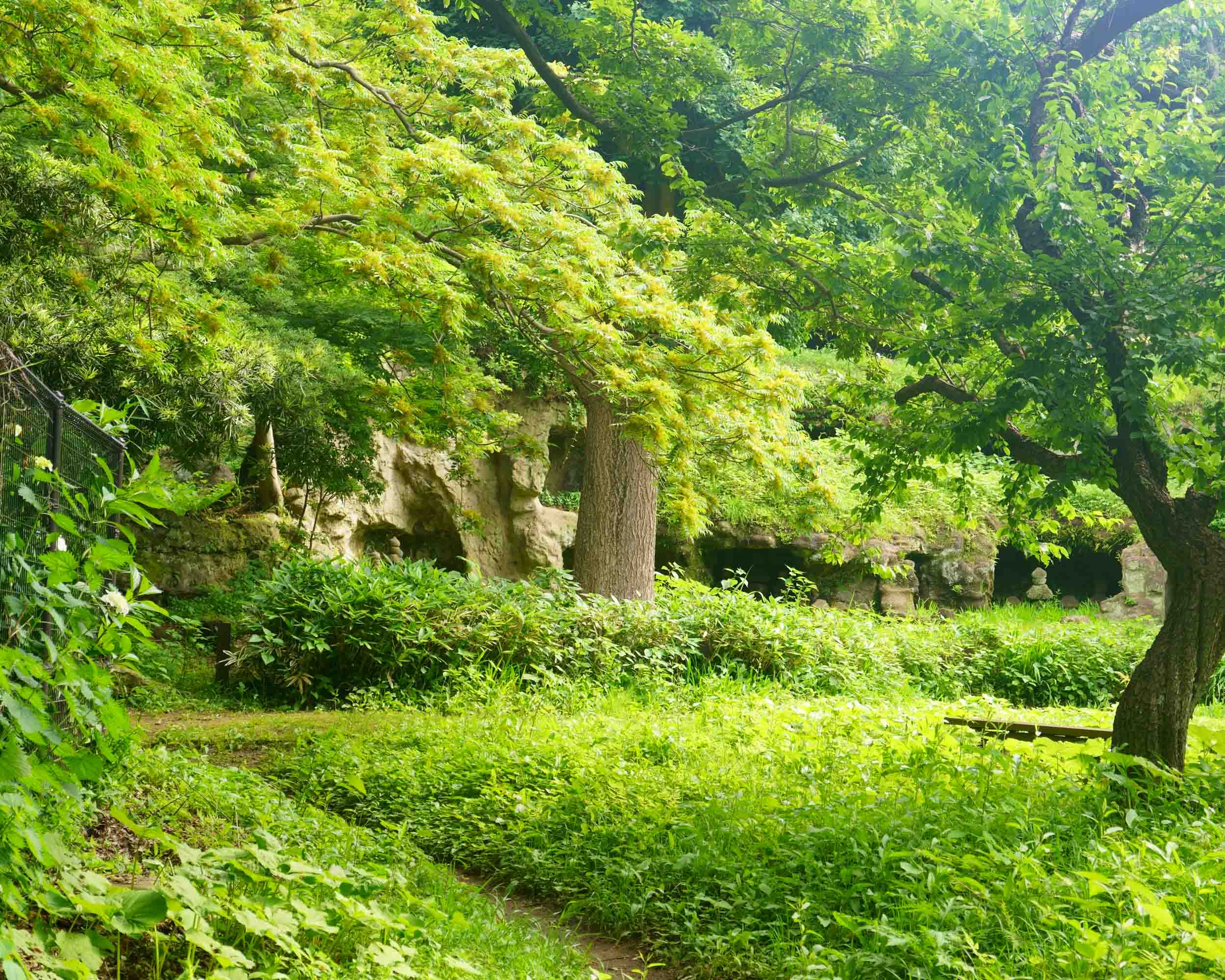
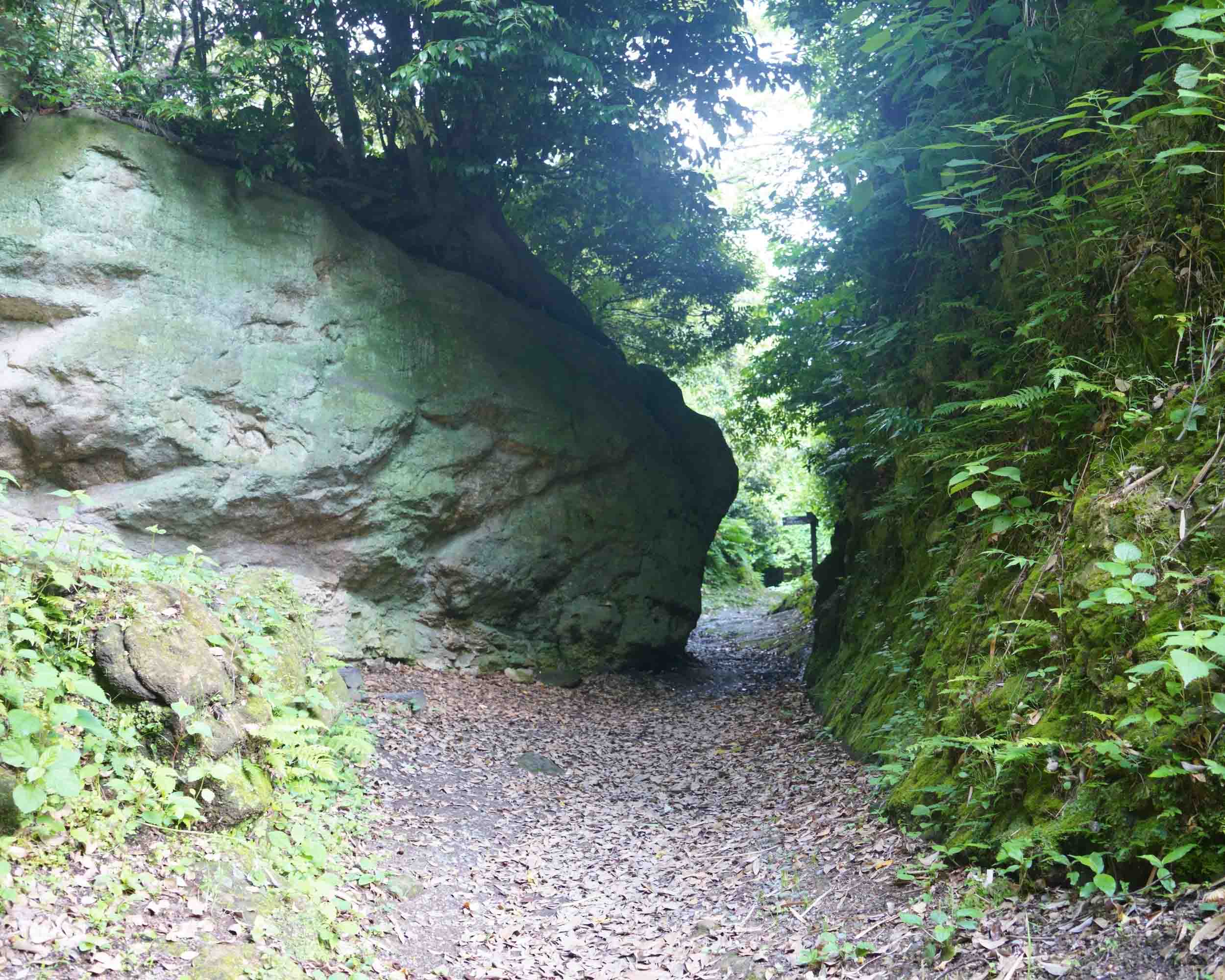
Nagoekiridoshi ⓮
The Nagoe Kiridoshi is one of the seven exits of Kamakura and was a key road connecting Kamakura and the Miura Peninsula. It was also a part of the Uraga Road leading from Totsuka-juku to Uraga via Kamakura.
Nagoe-ji (also called “Nagoezaka”), which includes a cut-through road, was once one of the few overland routes connecting Kamakura to the Miura Peninsula, along with Kotsuboji to the south. The name “Nagoshi,” which is also the name of the area, is said to derive from the fact that this road was so steep that it was called “Nakoshi.
Before the start
(one’s) whereabouts
Check the restroom
There is one public restroom in the middle of the course. There is one near the front of the course, but not near the finish line.
See Toshi’s Kamakura Hiking Map for detailed locations of restrooms.
Packed lunches and beverages
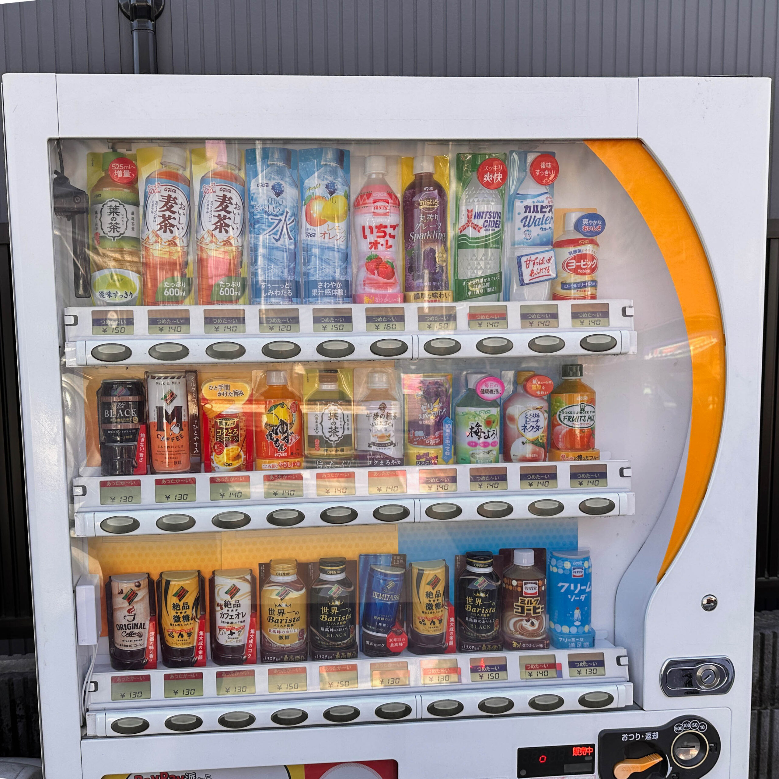
vending machine
It is not located in the middle of the course, but near before the start/after the finish line.
For information on nearby vending machines, see Toshi’s Kamakura Hiking Map
(The photo shows Vending Machine at the Chosho-ji bus stop.)
