About this site
We would like to thank you for choosing Toshiz Place from among the many lodging facilities available.
Here, we would like to make suggestions to enhance your stay and make your stay even more rewarding with new discoveries.
Use of Google MyMap
When I actually walked the course for the first time, somewhere in my mind, I always had this anxiety.
Is this the right path?”
Will there still be more hills and narrow streets like this?”
How much longer will we be there?”
I realized that I did not have time to look at the scenery or the little flowers on the side of the road, and that I was not truly enjoying myself.
I made a detailed My Map, thinking that if I could remove as much anxiety as possible beforehand, I would be able to enjoy my first time on the road.
We will be glad if you can make use of this information before touring the course.
Enjoy a course with a different flavor!
Take advantage of our course introduction video
An introductory video is available on each course page.
I think it will be a lot easier just to watch the video and know what is going on beforehand.
In the future, we would like to try to include up-to-date information about the seasons, stores, etc., as well as a video introducing the spot.
Please look forward to it.

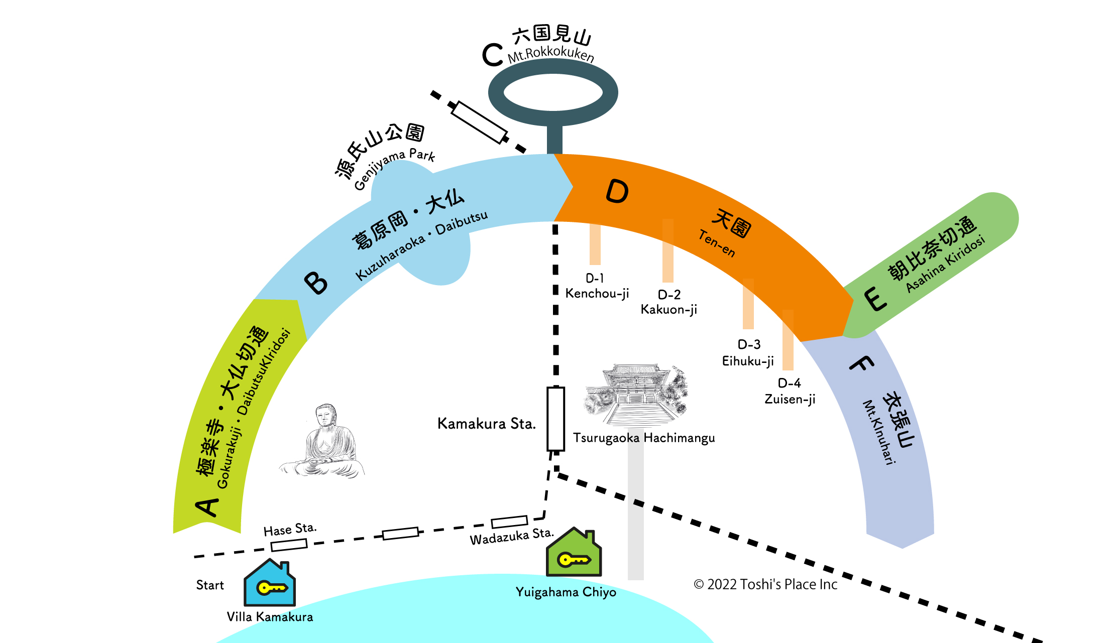
From Kuzuharaoka to the Great Buddha of Kamakura
Approx. 2 hours

From Kenchoji Temple in Tenen to Shishimai Valley
Approx. 2 hours 35 minutes

Rokkokuzan
Approx. 1 hr. 35 min.

Nagoshi-kiridoshi, Mt.
Approx. 2 hours and 45 minutes

Asahina Cut-through
Approx. 2 hours

Daibutsu Cut-through
Approx. 50 min.

Imaizumi Exit from Tenen/Zuisenji Exit
Approx. 2 hours and 40 minutes
Hiking goods available at Villa Kamakura